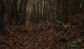

La Flèche Nord

tracegps
Gebruiker

Lengte
31 km

Max. hoogte
110 m

Positief hoogteverschil
313 m

Km-Effort
35 km

Min. hoogte
26 m

Negatief hoogteverschil
315 m
Boucle
Ja
Datum van aanmaak :
2014-12-10 00:00:00.0
Laatste wijziging :
2014-12-10 00:00:00.0
2h15
Moeilijkheid : Medium

Gratisgps-wandelapplicatie
Over ons
Tocht Mountainbike van 31 km beschikbaar op Pays de la Loire, Sarthe, La Flèche. Deze tocht wordt voorgesteld door tracegps.
Beschrijving
Petite boucle agréable au départ de la Flèche. Quelques beaux chemins creux. Retour par les bords de loir jusqu'au centre ville. Difficulté moyenne.
Plaatsbepaling
Land:
France
Regio :
Pays de la Loire
Departement/Provincie :
Sarthe
Gemeente :
La Flèche
Locatie:
Unknown
Vertrek:(Dec)
Vertrek:(UTM)
719472 ; 5286724 (30T) N.
Opmerkingen
Wandeltochten in de omgeving

La Flèche Sud


Mountainbike
Medium
(2)
La Flèche,
Pays de la Loire,
Sarthe,
France

46 km | 51 km-effort
3h 15min
Ja
La Flèche - Saumur par les chemins


Mountainbike
Medium
La Flèche,
Pays de la Loire,
Sarthe,
France

88 km | 99 km-effort
5h 0min
Neen
La Flèche - Grande Boucle Sud Ouest


Mountainbike
Moeilijk
La Flèche,
Pays de la Loire,
Sarthe,
France

84 km | 96 km-effort
6h 0min
Ja
Tour de la Flèche en 4 Jours


Mountainbike
Gemakkelijk
La Flèche,
Pays de la Loire,
Sarthe,
France

163 km | 181 km-effort
16h 0min
Ja

La Flèche, Luché pringé


Fietstoerisme
Gemakkelijk
La Flèche,
Pays de la Loire,
Sarthe,
France

33 km | 35 km-effort
2h 15min
Neen
Nico tout seul très beau temps


Mountainbike
La Flèche,
Pays de la Loire,
Sarthe,
France

29 km | 32 km-effort
1h 35min
Ja
La Flèche - Grande Boucle Nord Est


Mountainbike
Moeilijk
La Flèche,
Pays de la Loire,
Sarthe,
France

88 km | 101 km-effort
6h 0min
Ja
La Flèche Nord Ouest


Mountainbike
Gemakkelijk
La Flèche,
Pays de la Loire,
Sarthe,
France

35 km | 39 km-effort
2h 30min
Ja
La Fleche - Nord Est


Mountainbike
Medium
La Flèche,
Pays de la Loire,
Sarthe,
France

42 km | 48 km-effort
3h 0min
Ja


 SityTrail


